An Illustrated Map of a Pennsylvania Farm
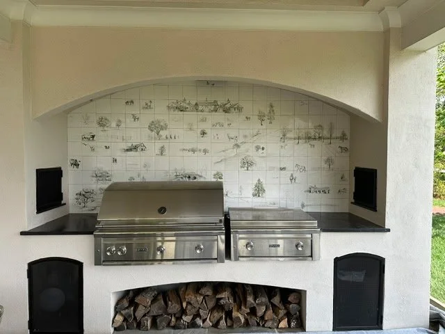
Set across four hundred and fifty acres of historic farmland outside Philadelphia, the brief was to create an illustrated map for an outdoor kitchen—one that felt as though it belonged to the landscape it depicted.
What followed was a three-year study of the farm.
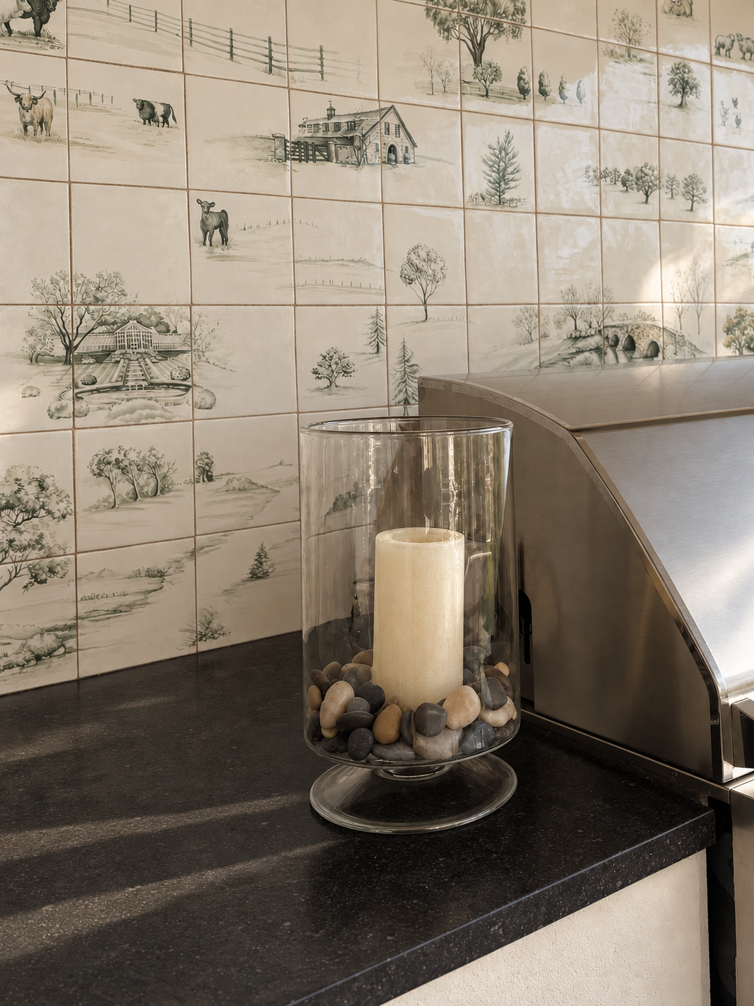
Drawing from historic maps, horse portraiture, toile, satellite imagery and on-site research, we documented its architecture, roads, trees, animals and landmarks. Even the horses were studied in consultation with an equine veterinarian. The finished design tells the story of the farm through its landscape, landmarks, and natural details.
Year
2023 - 2026
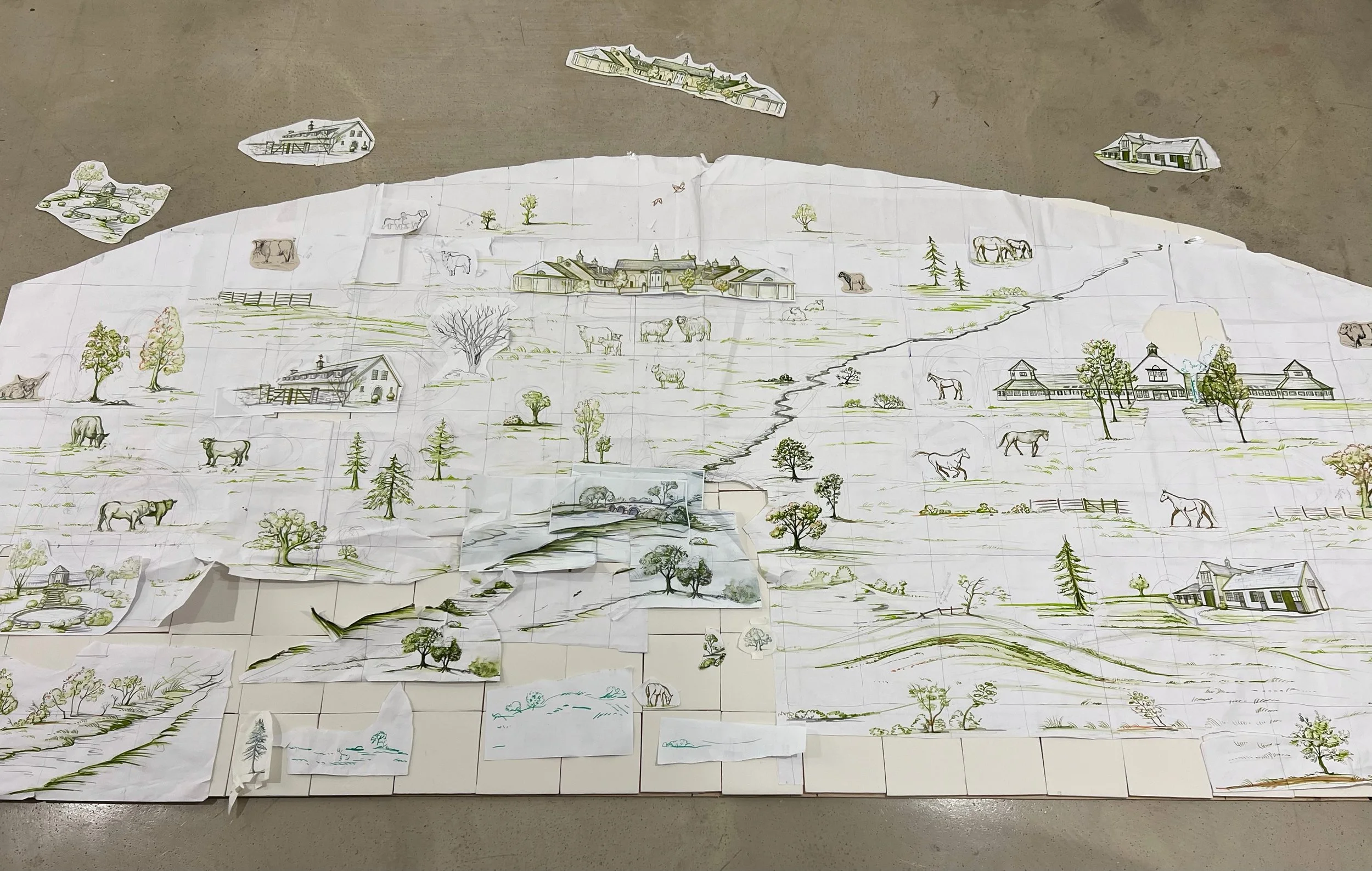
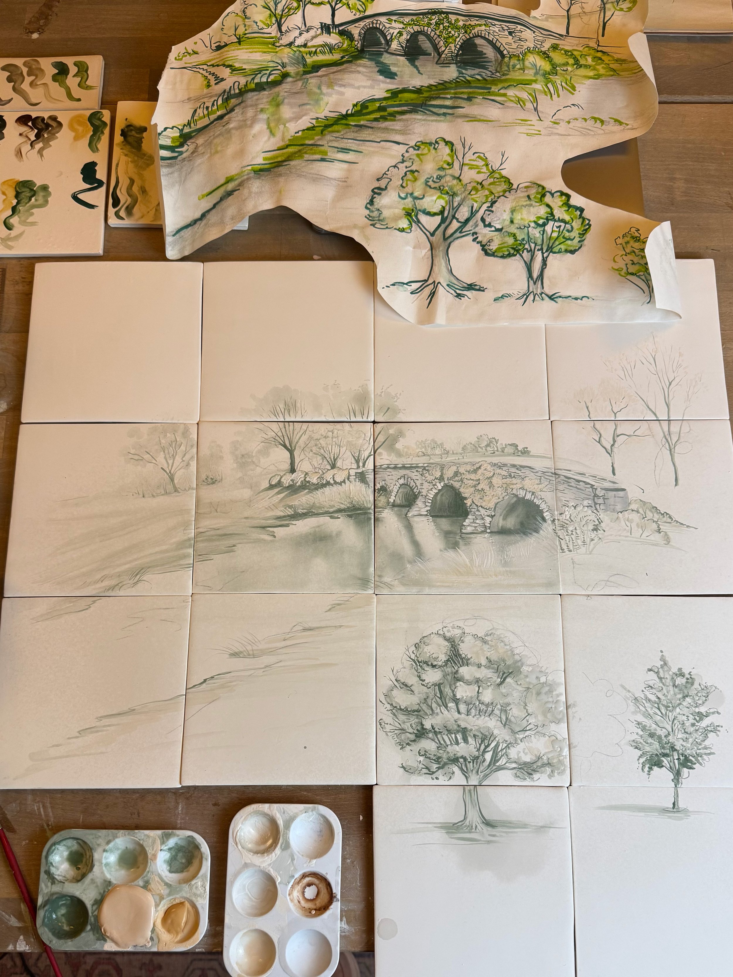
Drawing the landscapeAcross thirty drafts, the composition became increasingly verdant. Individual illustrations gradually gave way to a continuous six-foot landscape, rendered in green, grey and rust drawn from the property's painted trim, stucco and stone.
Made for place
Over two days on site, final placement and alignment were resolved in direct conversation with the architecture and landscape.
What began as a map became something more personal: a record of the landscape and the particular way one family knows it. Designed not simply to depict the farm, but to belong to it.
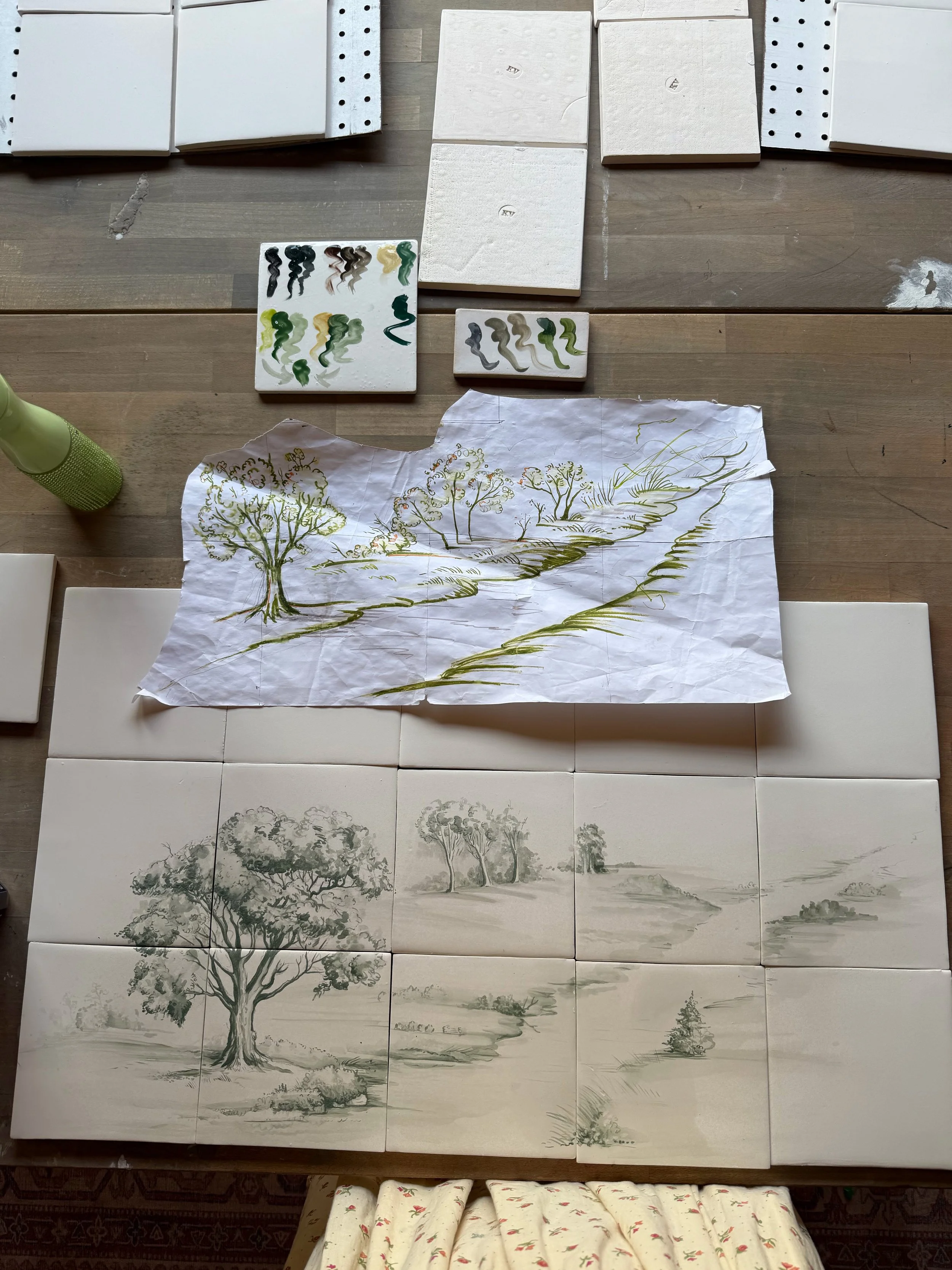
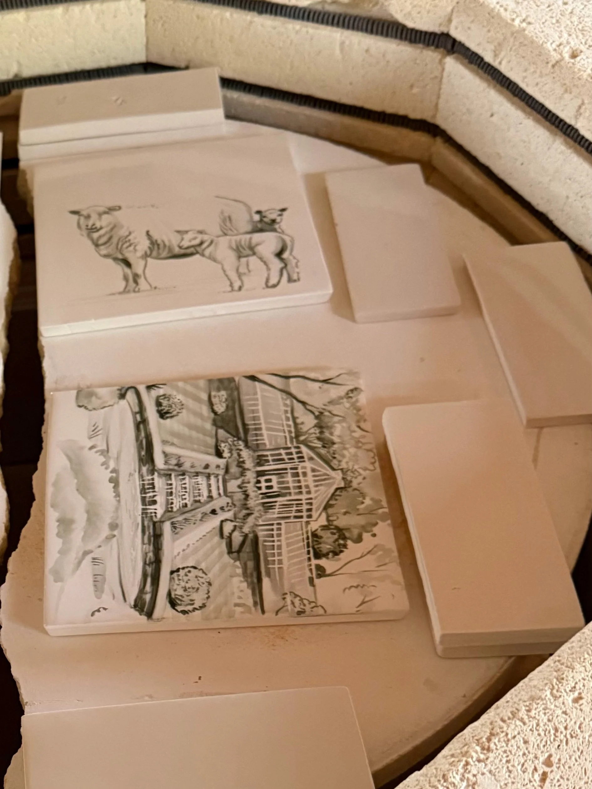
The illustration was translated across six-inch tiles using our proprietary frost-resistant clay, with a custom-cut arch designed precisely for the outdoor kitchen. Every line and tonal shift was considered against grout joints and the natural irregularities of handmade tile.